Plan for today!
Ride across the Salar de Uyuni and on to Oruro . 260 km+/-.
After taking to the hotel owner it was clear the route on
the Salar out to the Isle de Cactus was ok but there were possible soft areas
to the north.
But first, fuel. Oops, no fuel at first station or the
second station. We parked on the forecourt and contemplated our options. The
attendant indicated no fuel until manana. However I noted he waved away a taxi
while we were sitting there. We were joined by a truckie and a Swiss gentleman
with a 4wd also looking for fuel. When it was clear we were not going to leave
he flagged in a taxi which lead to more taxis turning up. They obviously keep a commercial transport reserve. He finally decided to
give us fuel at the “tourist” rate. Over three times the going rate. He had us
park away from the forecourt, waited until no-one was about then flagged us in
one at a time to top up and get off the forecourt. We had fuel!
Off to the Salar. At the edge were teams of men shoveling
salt onto large trucks and there were evident wet areas. A worker came over and
gave the info we needed to get started.

Under way on the hard salt pan, knowing
you were heading for a small island somewhere in the middle, was eerie at first
but zipping along at 100 kph on the
white expanse seemingly getting nowhere was quite an experience. After the
first 15 mins there was a building and stand of flags.
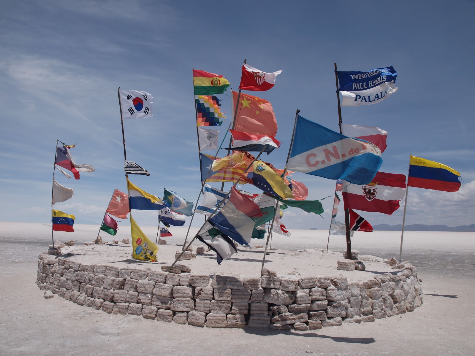
Some commercial guys asked where we were headed, looked at our plan, and assured us the
entire route would be hard and dry. Yeehaa!
It took another 30 mins before the Isle de Cactus appeared
over the horizon and another 30 mins before we arrived.


The Island is covered with
Cuctus, hence the name, some est. at 2000 yrs. We stopped at the leading edge
for photos before heading around a headland and put the billy on.

It’s now the
illusion of being completely alone is shattered and we had lunch at the Island restaurant. There was quite and international
gathering and we plus bikes became the center of attention, briefly. Talking to
one of the guides we pointed out our intended route to the north and a road
leaving the Salar on our map. He informed us he had never found that road, hmm.
We took off on a direct line and found the road off the Salar, albeit through a
short soft section.
What an experience!

Well we got off the Salar. No roads showing on the GPS so we
followed a number of extremely rough goat trails to east through a number of
small villages. This lead to a larger goat trail which happened to be a major
route given the number of buses we passed. It was dark when we hit highway one
to Oruro . We
met a number of Army and Police check-points on the way.
Monday 3
December. Oruro
– La Paz – border crossing at Desaguadero, Lake Titikaka
Lethal driving tactics, overloaded diesel belching trucks,
and plastic rubbish everywhere. Not too inspiring and you learn quickly motorbikes have
nil rights.
We were singled out by a corrupt Police check-point just
short of the border crossing, We were taken aside, all documents inspected and
after carefully selecting the back of a customs document the head offender put
a stamp on the back of it and held out a bucket for the “Donation”. The
document is conveniently surrendered to customs so you do not get to keep the
evidence. We crossed into Peru
and stopped the night on the edge of Lake
Titikaka

Tuesday 4 December.
No comments:
Post a Comment